1.
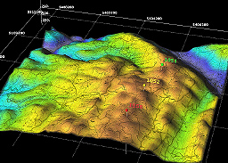
DEM stands for digital elevation model and is an image that represents elevation on Earth’s surface and is in turn made into digital representations and 3-D images. This example represents the 3D graphics and the multilayer map that uses transparencies to represent the important characteristics.
No comments:
Post a Comment